Geospatial Valuation Data Warehouse
Centralize your valuation reports and map market comparables with AI precision. Designed to handle complex, multi-location portfolios, our platform blends cutting-edge automation with strict compliance to SPI and KEPI standards.
Platform modules
Seven modules. One integrated data warehouse.
Every module connects to the same normalized geospatial database — preventing data duplication, inconsistencies, and orphaned spreadsheets.
Platform modules
Seven modules. One integrated data warehouse.
Every module connects to the same normalized geospatial database — preventing data duplication, inconsistencies, and orphaned spreadsheets.
warehouse.kjpp.id/dashboard
01 / 07
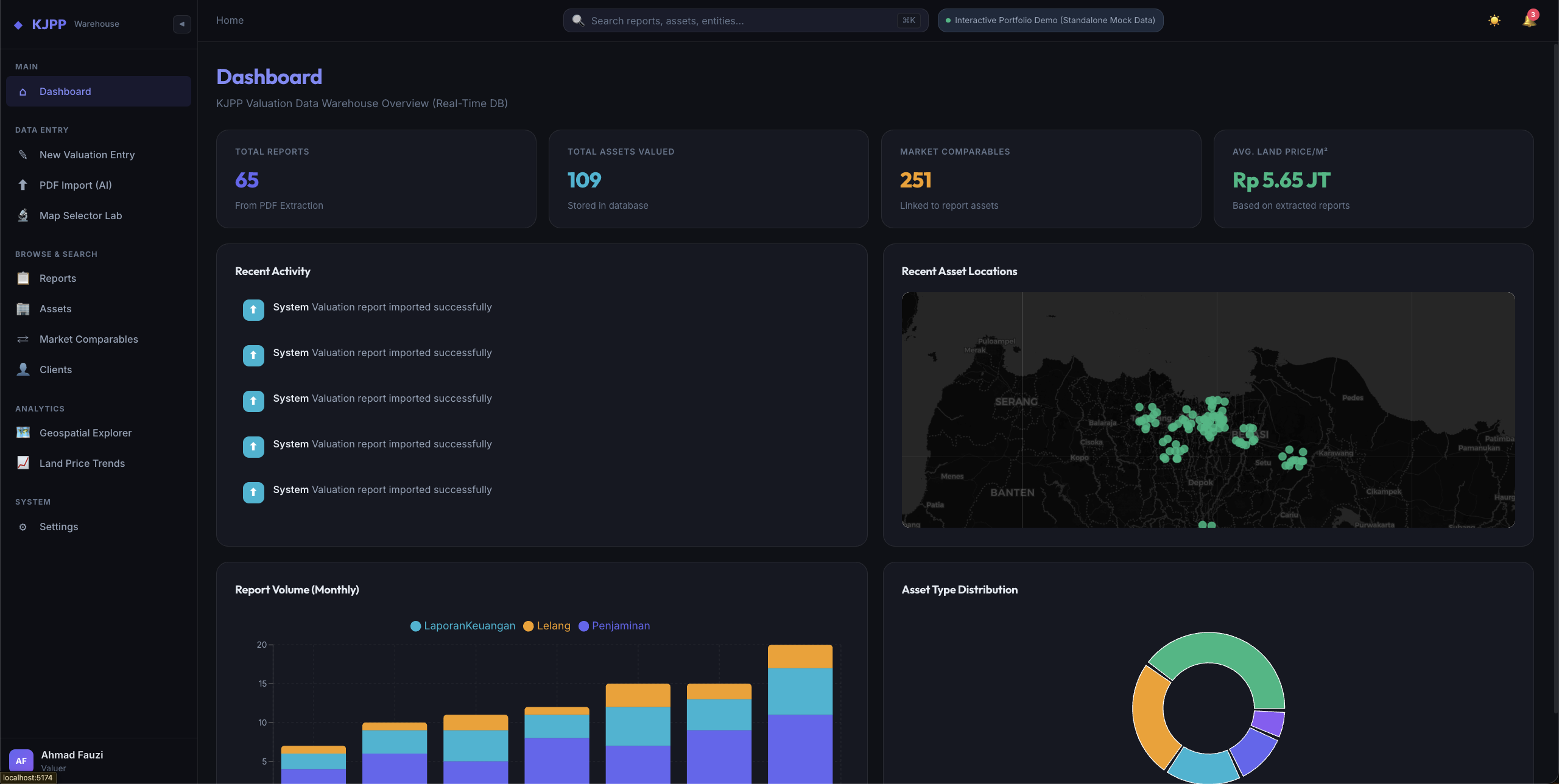
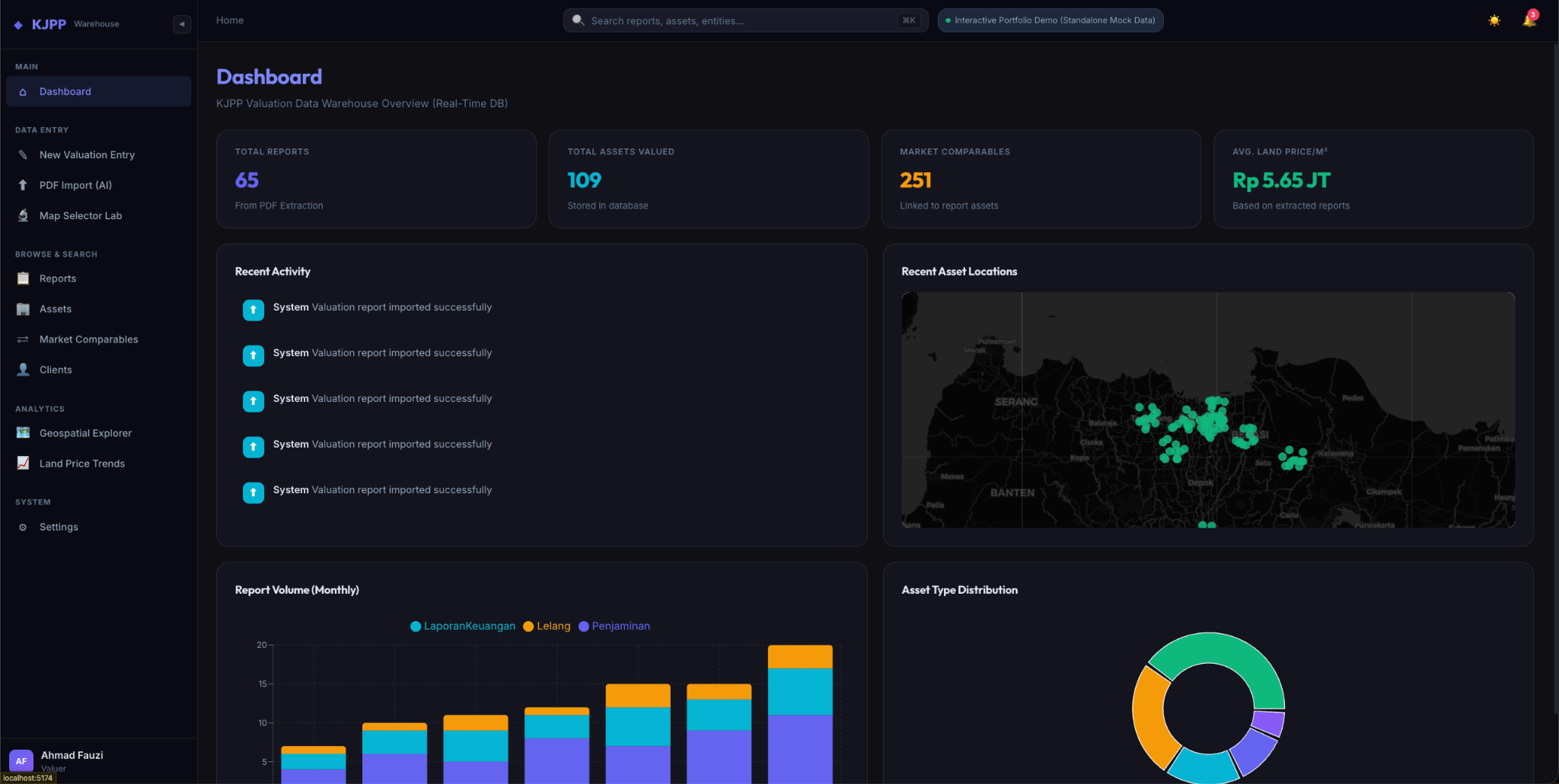
Command Center for Valuation Operations
Gain complete visibility over your appraisal activities. This dashboard delivers instant KPIs on your total valuation reports, asset distributions, and market comparables availability. Turn raw data into strategic metrics on a single screen.
- Live KPIs
- Asset distribution
- Recent activity
warehouse.kjpp.id/dashboard
02 / 07
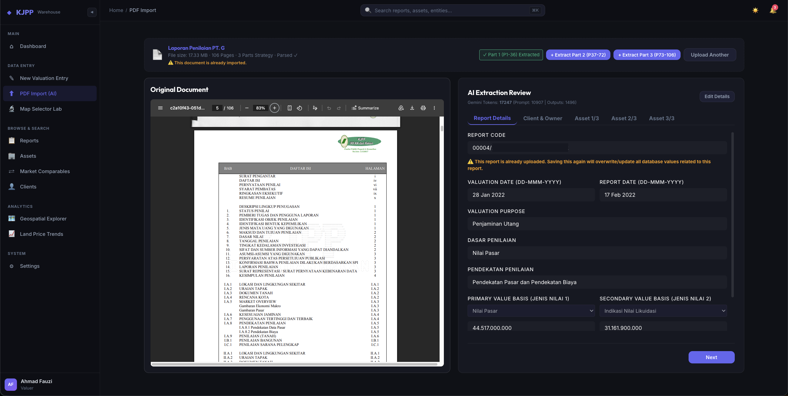
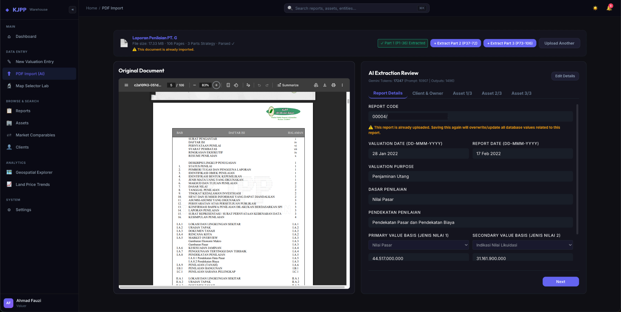
Automated Report Ingestion with AI
Leave manual data entry behind. Simply upload your valuation reports (PDF, Word, Excel), and our AI engine automatically extracts executive summaries, asset descriptions, and market comparables. Your data becomes structured, standardized, and ready to use in seconds.
- PDF / Word / Excel
- Semantic mapping
- Seconds, not hours
warehouse.kjpp.id/pdf-import
03 / 07
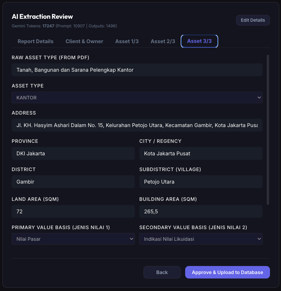
Absolute Quality Control by Appraisers
Automation still requires professional judgment. While AI speeds up extraction, you retain full authority to review and verify the data. Maintain the rigorous accuracy and industry compliance required without sacrificing time efficiency.
- Field-level review
- Approve & commit
- Audit trail
warehouse.kjpp.id/review
04 / 07
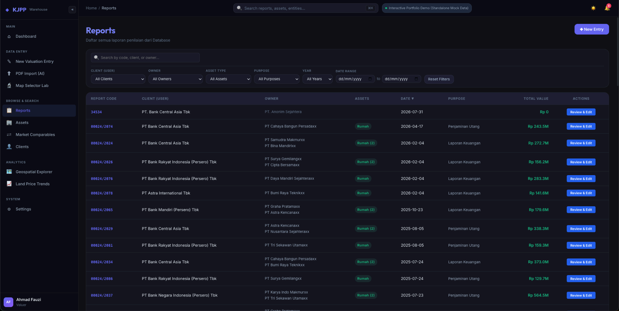
Centralized Engagement Management
Keep track of every valuation assignment effortlessly. All your reports are centrally archived with essential metadata, separating Client and Intended User. Use precision filters to instantly retrieve historical data relevant to your current project.
- Granular filters
- Client & user split
- Full metadata
warehouse.kjpp.id/reports
05 / 07
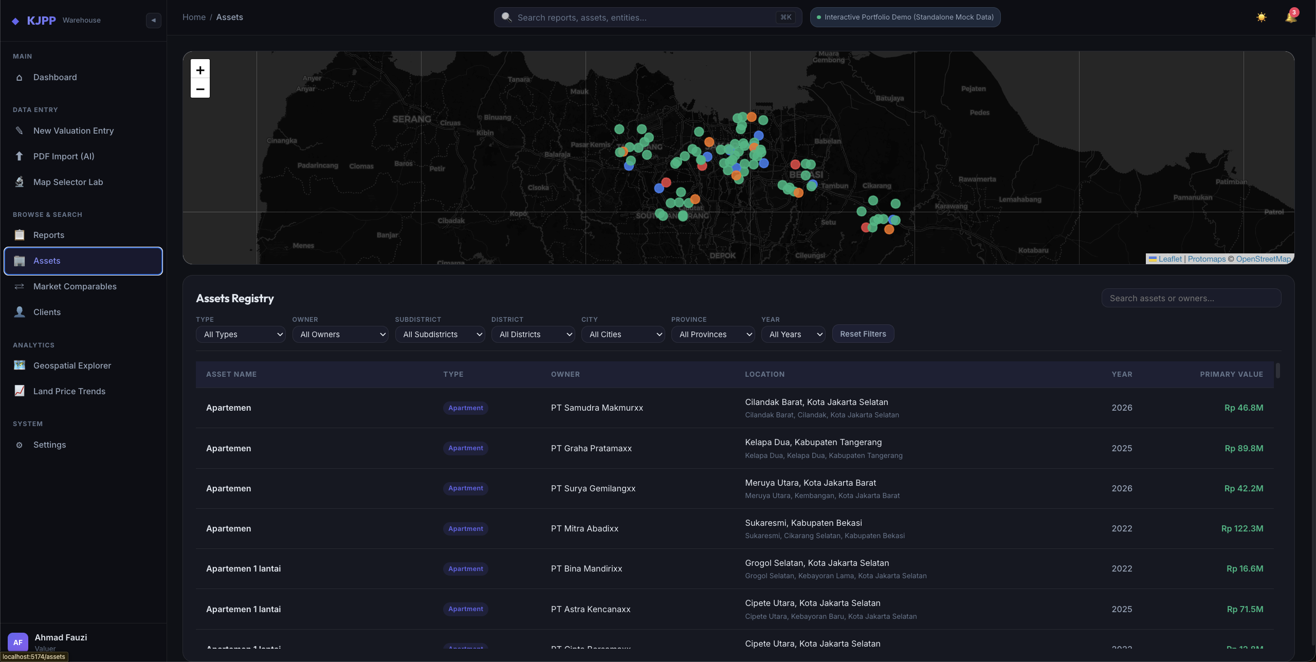
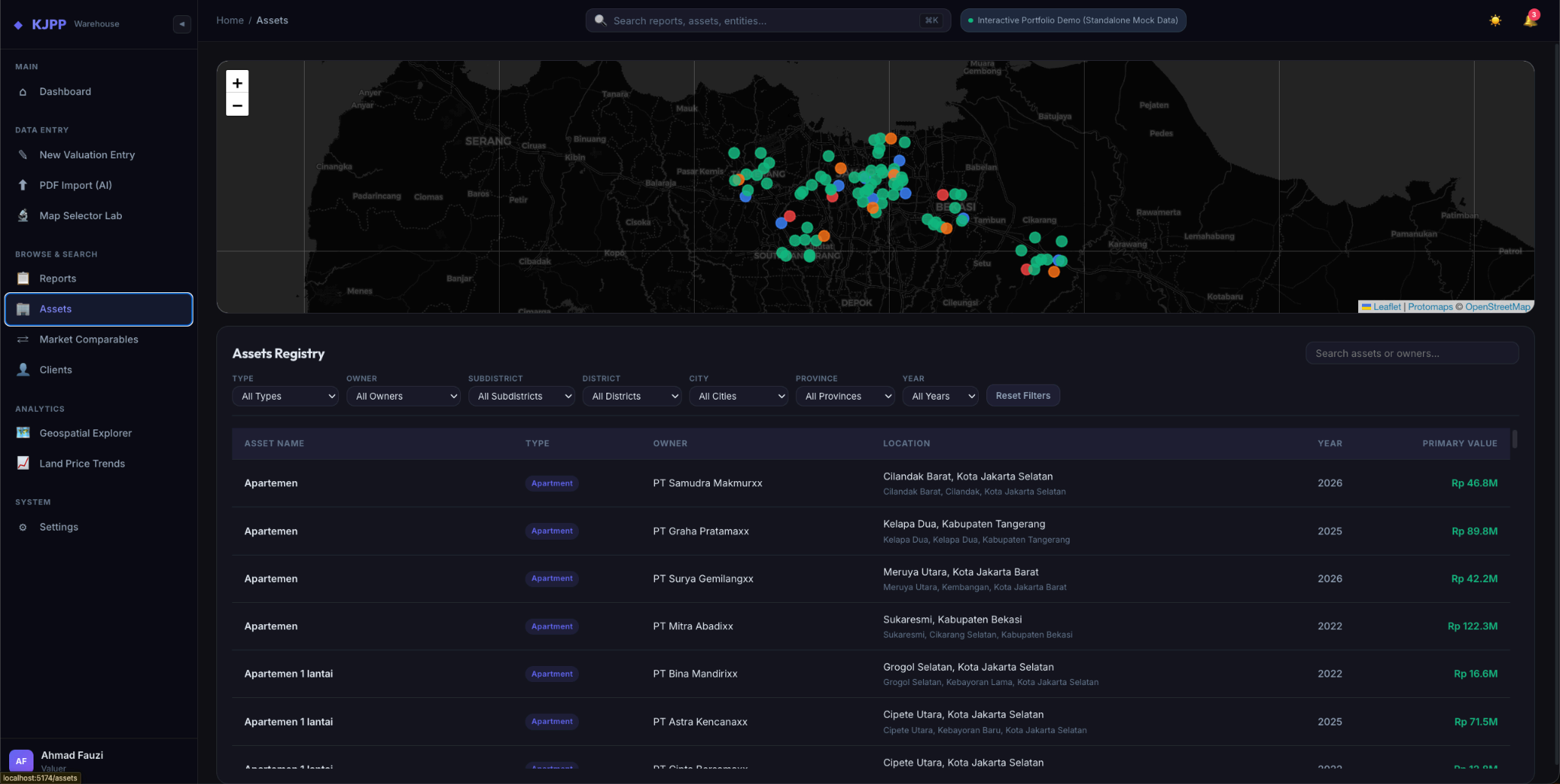
In-Depth Asset & Taxonomy Management
Navigate your entire history of evaluated assets easily. Whether real estate or machinery, you can search by owner, valuation year, location, or asset classification. Untangle the complexity of large-scale portfolios in one systematic view.
- Owner resolution
- Asset taxonomy
- Multi-location
warehouse.kjpp.id/assets
06 / 07
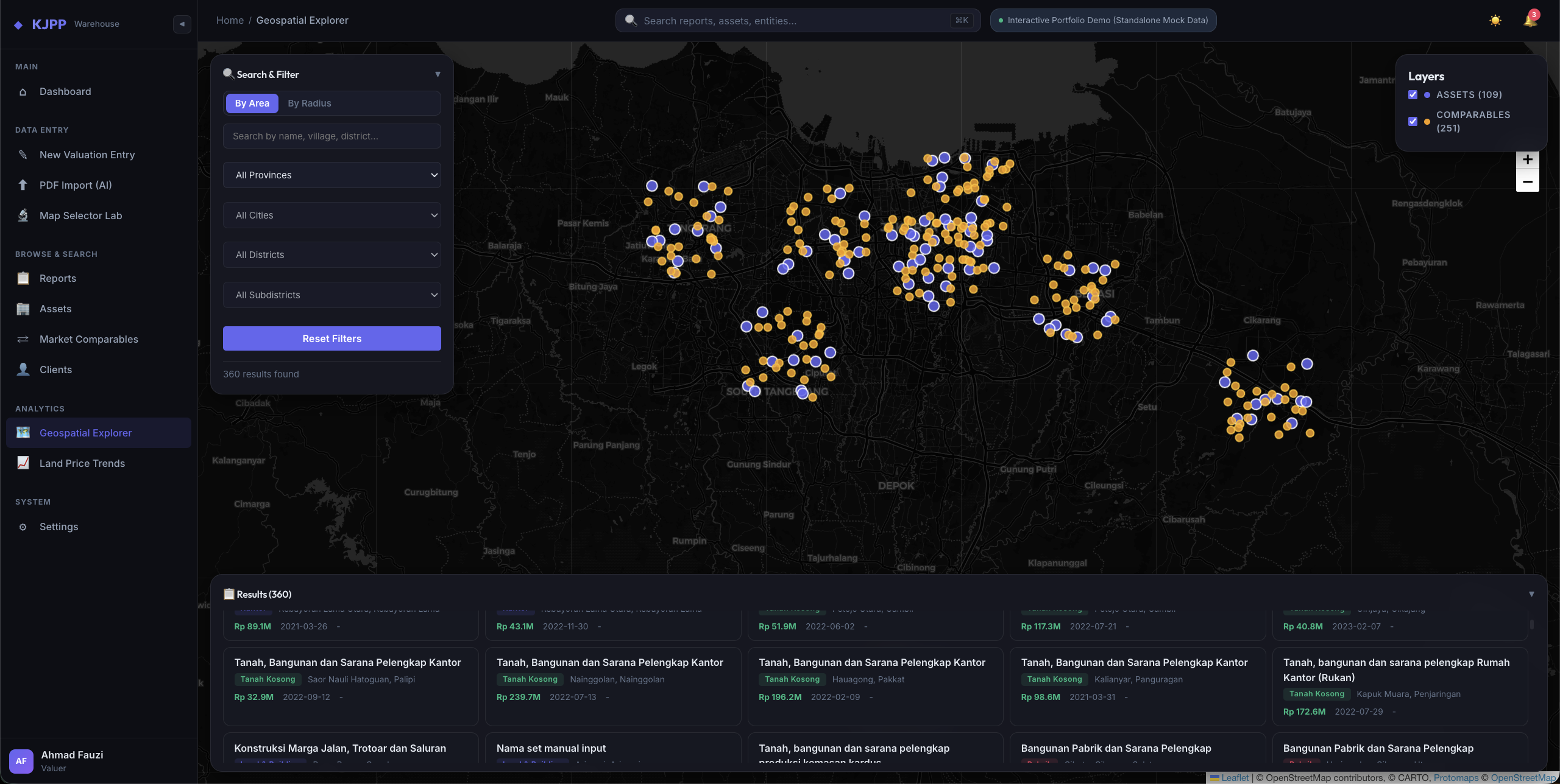
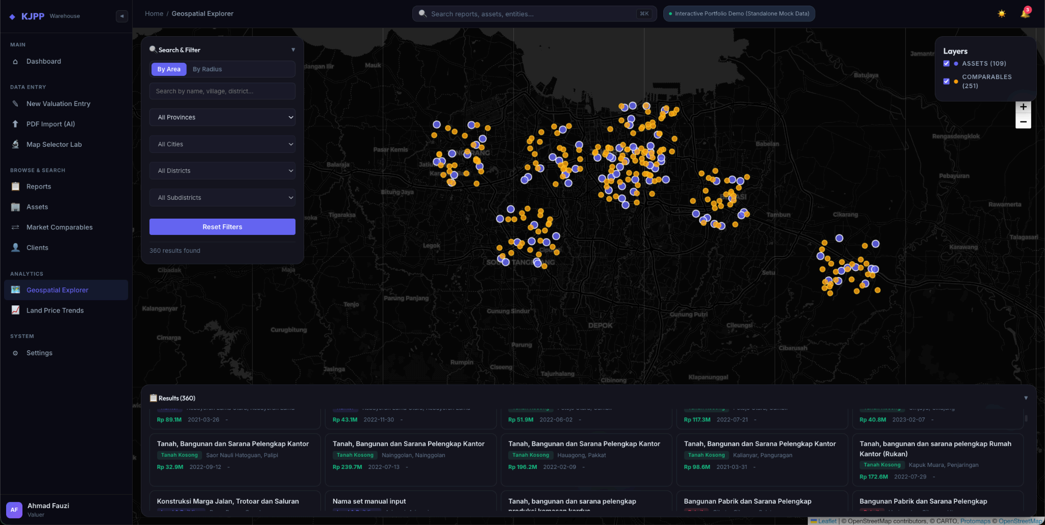
Spatial Analysis & Comparables Mapping
Visualize your Market Comparables comprehensively. Get an accurate picture of asset distributions on an interactive map. Validating distances and locations for comparables is now faster, smarter, and highly precise with geospatial support.
- Radius & area search
- Comparable layers
- Pinpoint plotting
warehouse.kjpp.id/geospatial
07 / 07
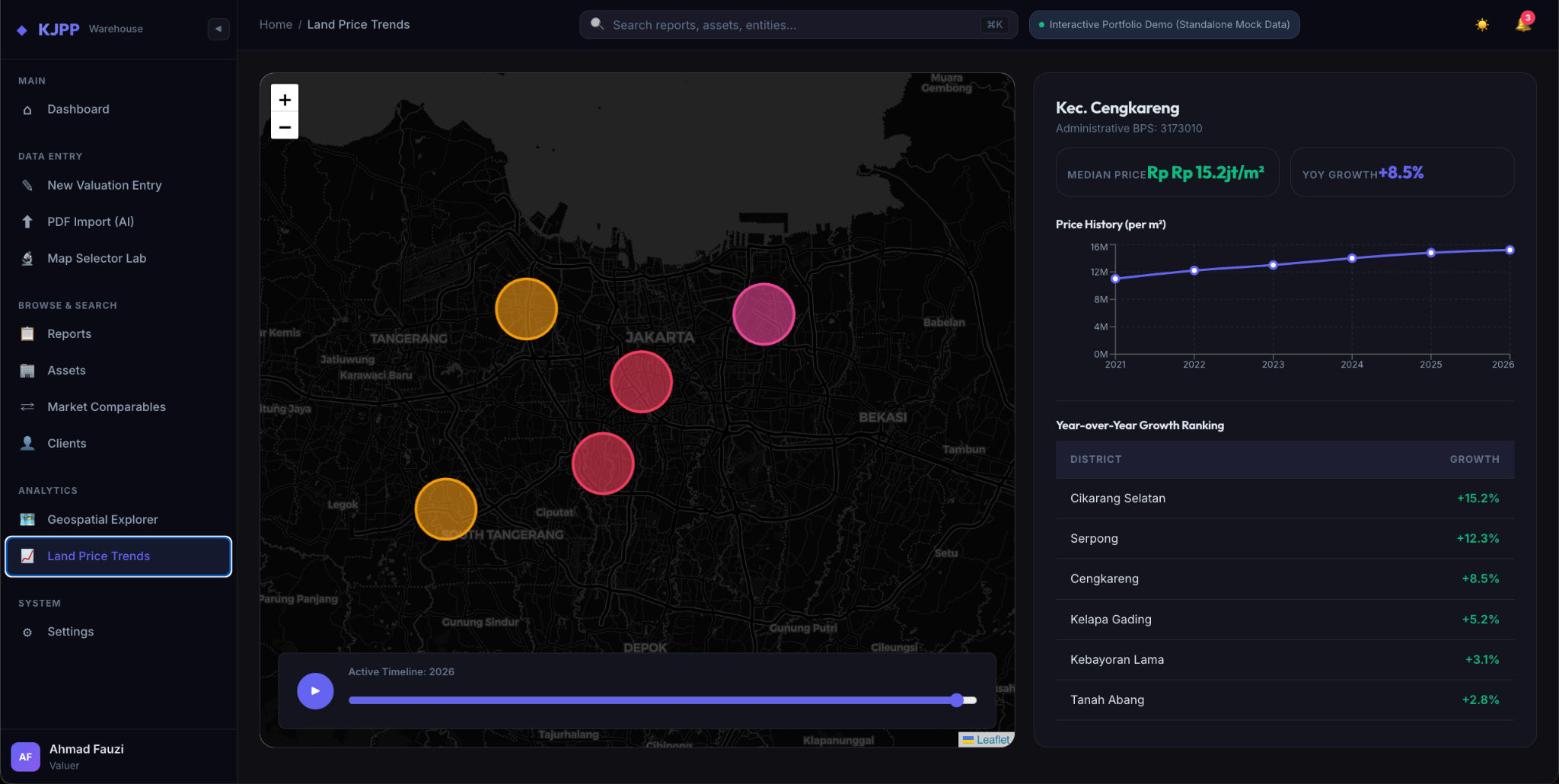
Land Value Trend Modeling
Analyze historical market value movements spatially and temporally. This feature automatically calculates median Market Value changes per square meter, presenting them in interactive choropleth maps to visualize regional appreciation trends (land value zoning).
- Median Rp/m²
- Choropleth maps
- Growth rankings
warehouse.kjpp.id/price-trends
AI semantic extraction
From unstructured Reports to an Integrated Database
The AI engine reads the document like a Public Appraiser would — then structures it exactly how a relational database requires.
- Upload
- Extract
- Map
- Verify
- Save
Laporan_Penilaian.pdf
- report_code
- client_entity
- asset_type
- land_area_sqm
- value_basis
- geometry
Under the hood
Robust Architecture, Zero Data Manipulation, Maximum Compliance
This platform is not just a dashboard; it is a geospatial data warehouse built on the "Zero Calculation Initiative" (storing only report facts, never derived assumptions). Built on a microservices Docker infrastructure, it uses self-hosted PostgreSQL & PostGIS for complex spatial queries. It technically isolates the Client, Intended User, and Asset Owner entities to comply strictly with SPI standards.
Centralize Your Valuation Data Today
Have specific appraisal workflows or custom requirements for your firm? Let's discuss how our system can be tailored for you.
kickaiinfo@gmail.comFAQ